Maps
Hunting, Fishing, Recreation, and Watersports Maps
Click the map icons below to view and/or download maps
|
|
|
||
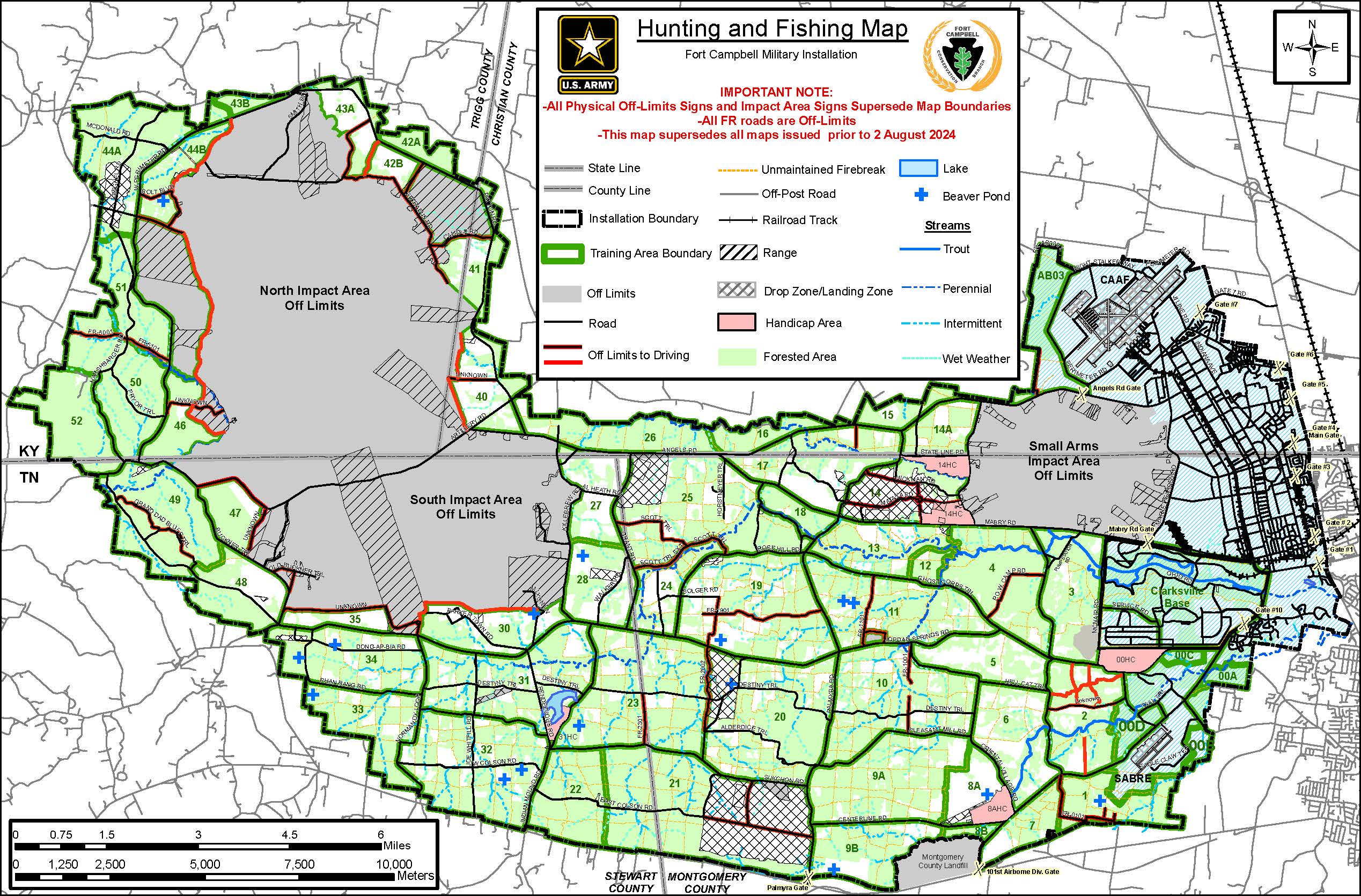
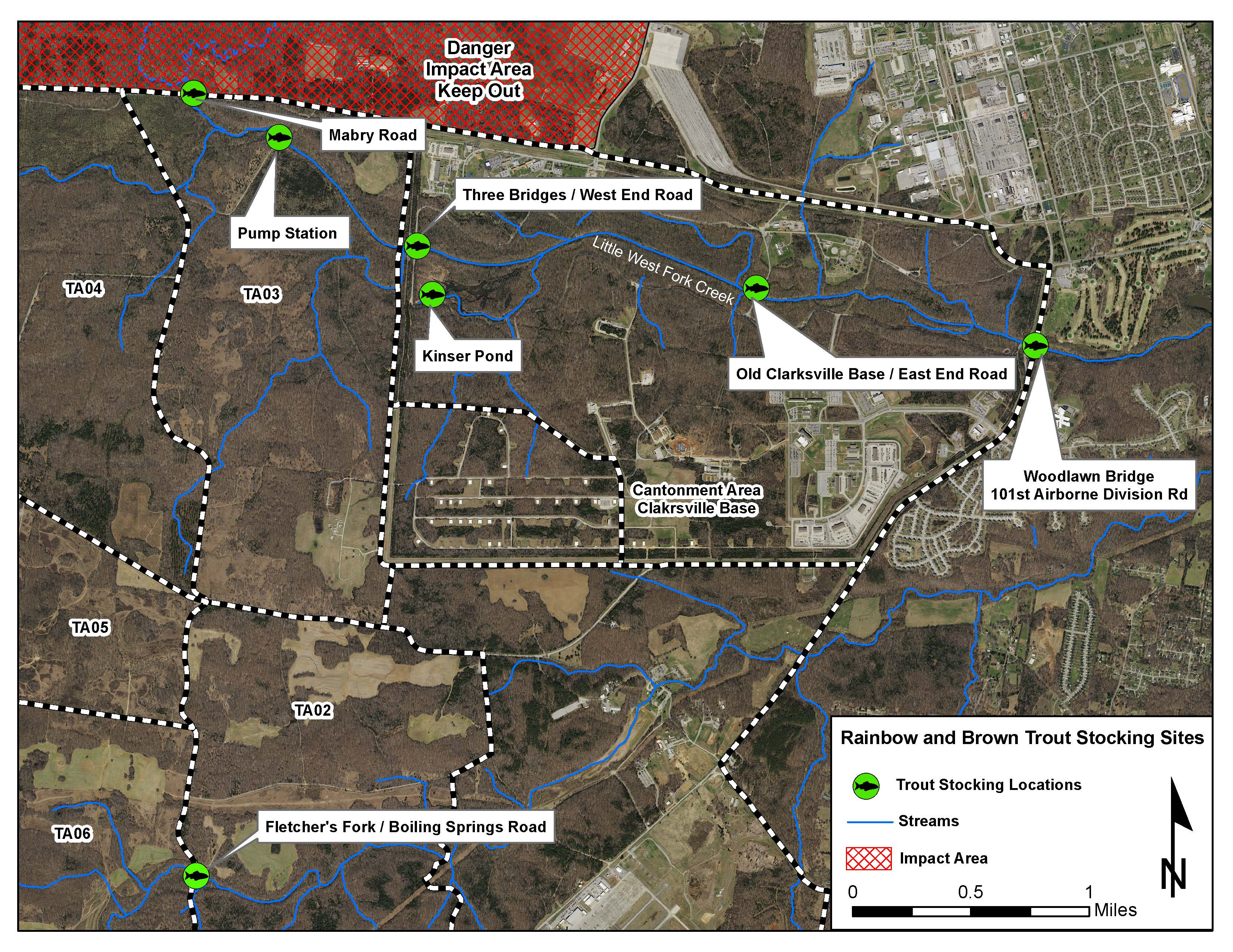
| Fort Campbell Map | Trout Stocking Map |
|
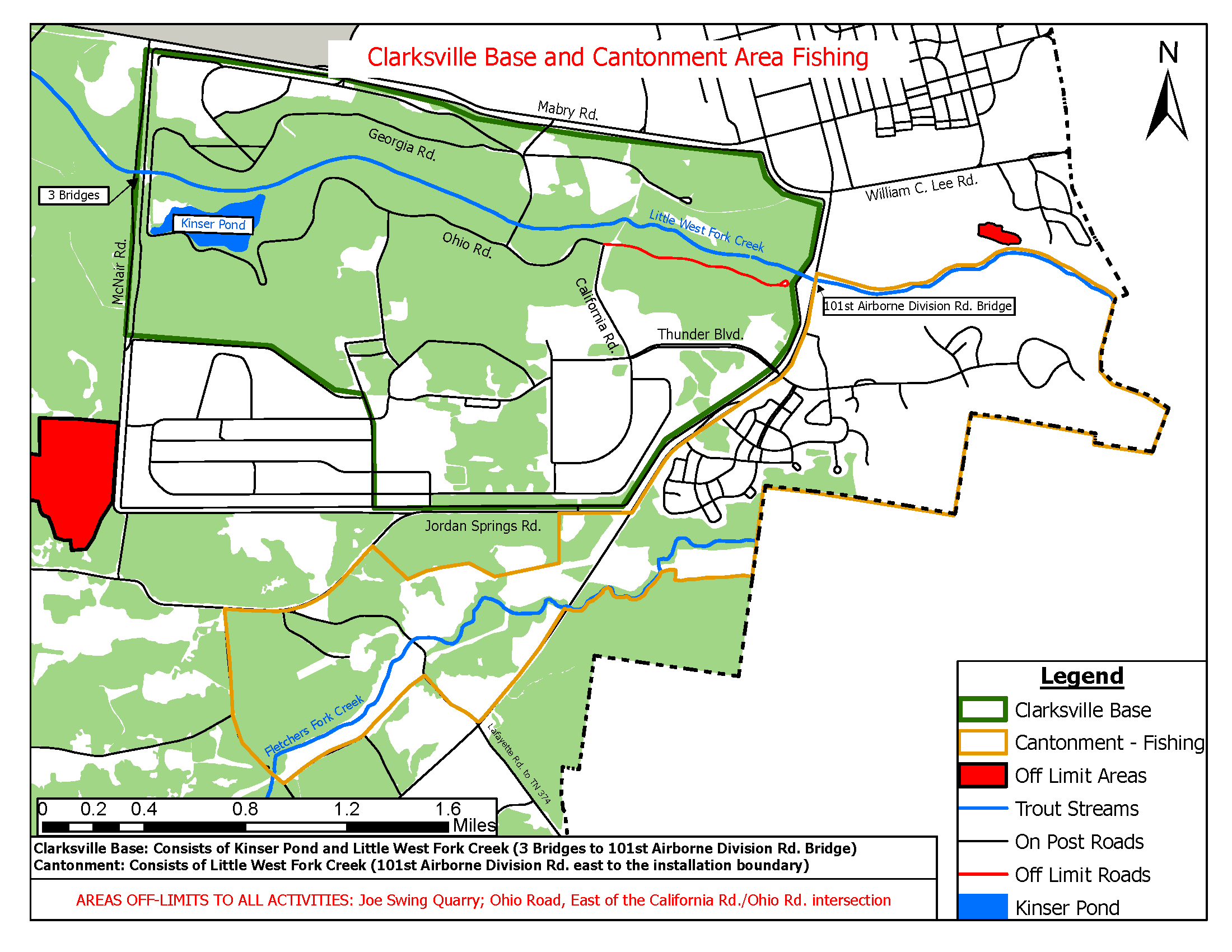
Clarksville Base and Cantonment Area Fishing Map |
Environmental Recreation/Watersports Activities Maps
|
|
|
|
|
||||
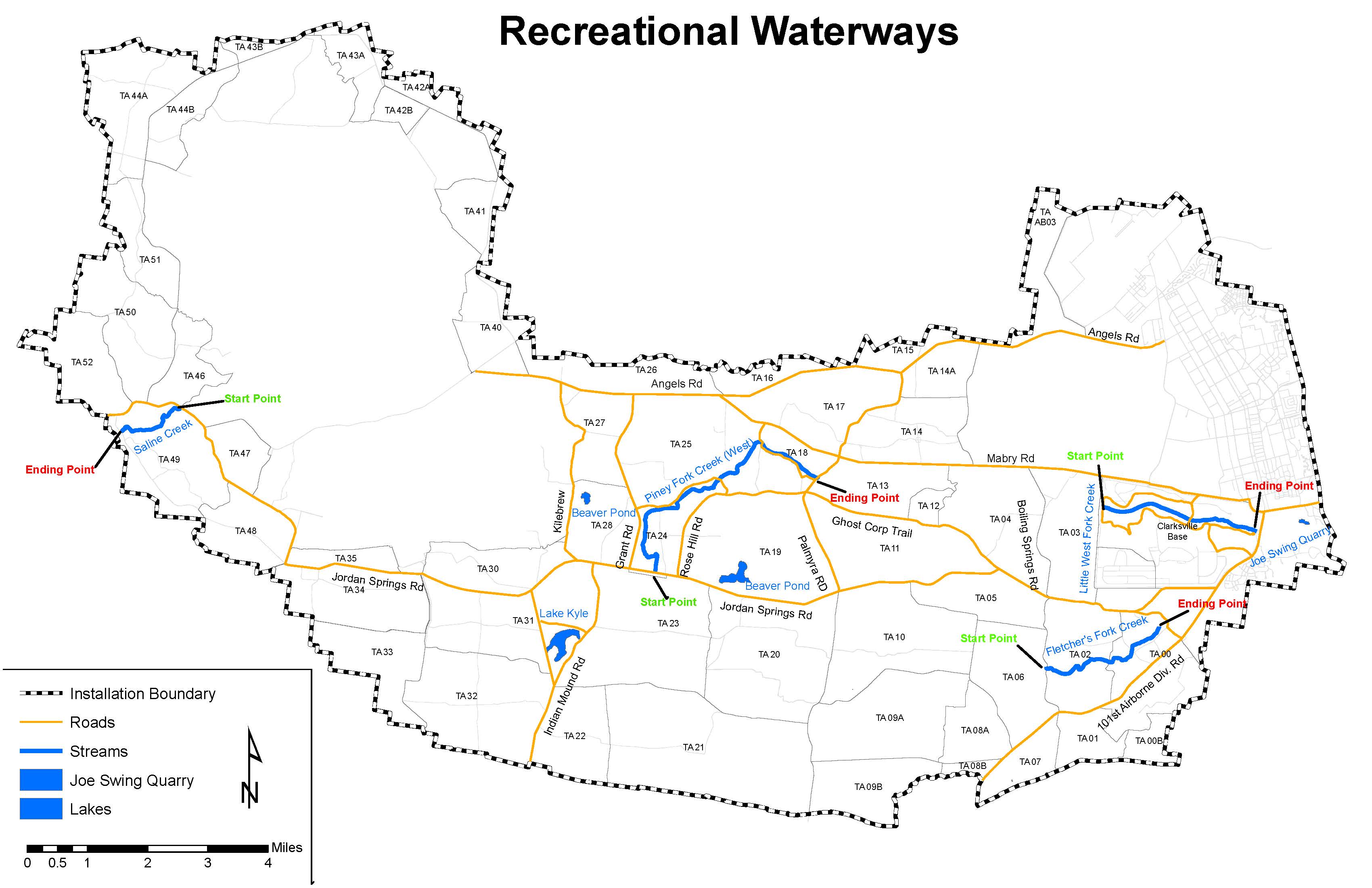
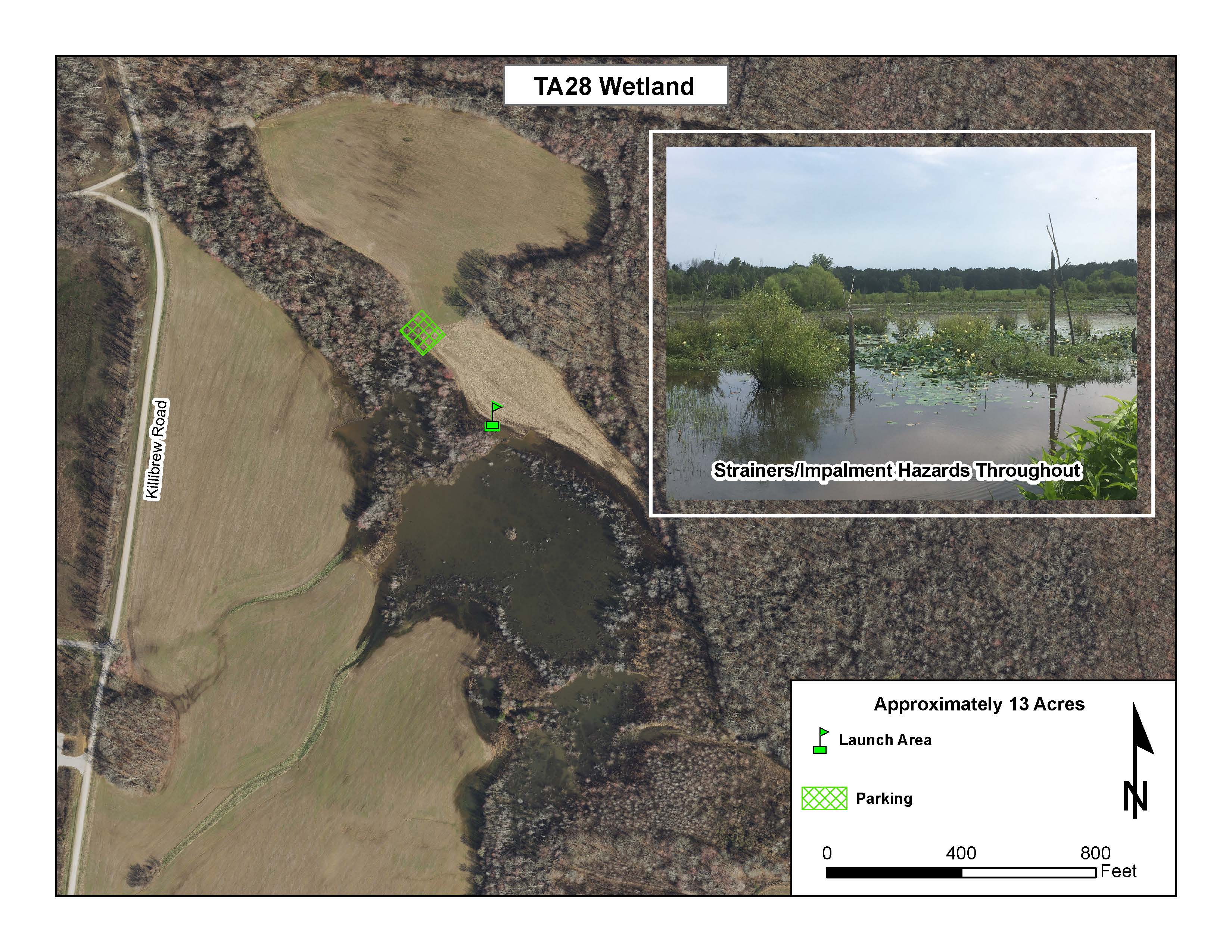
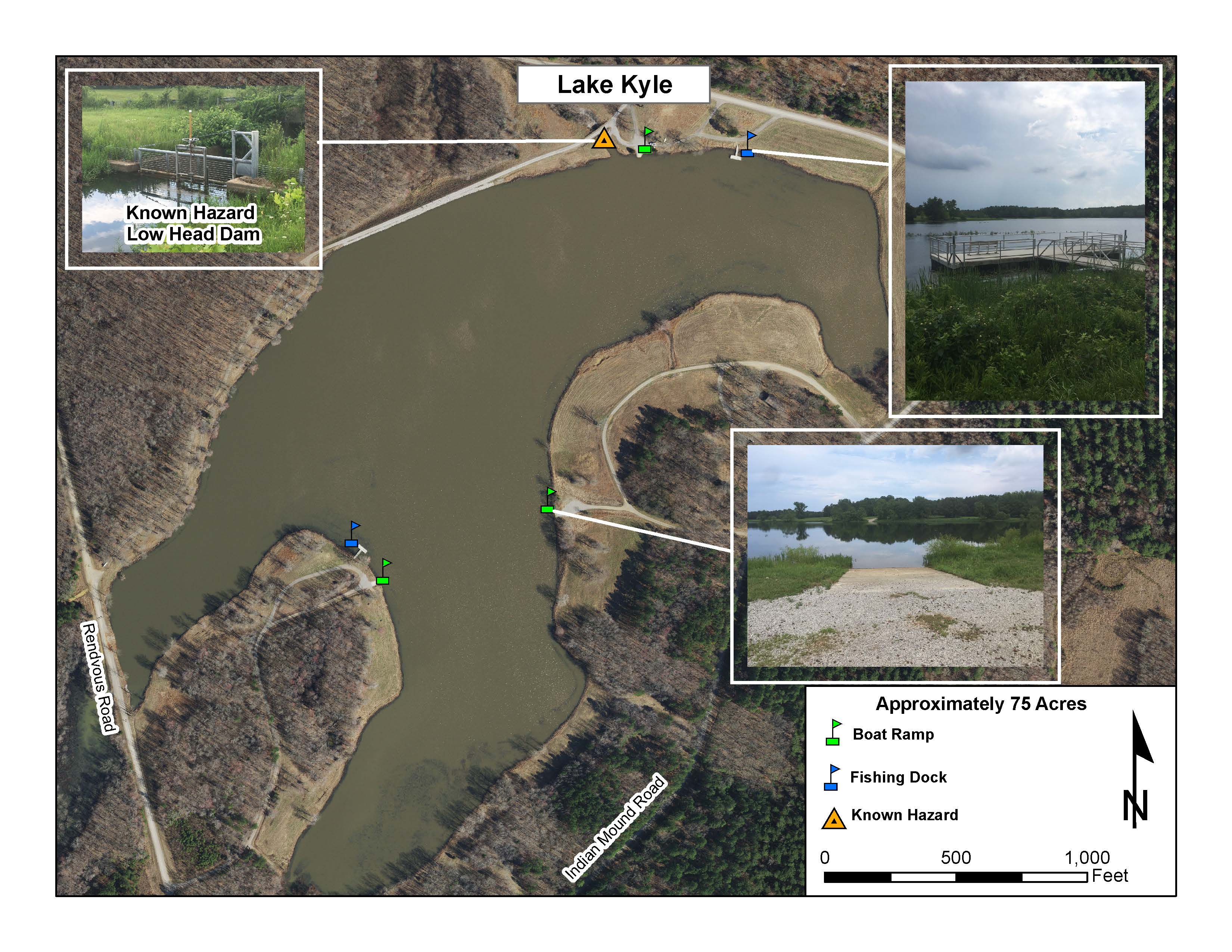
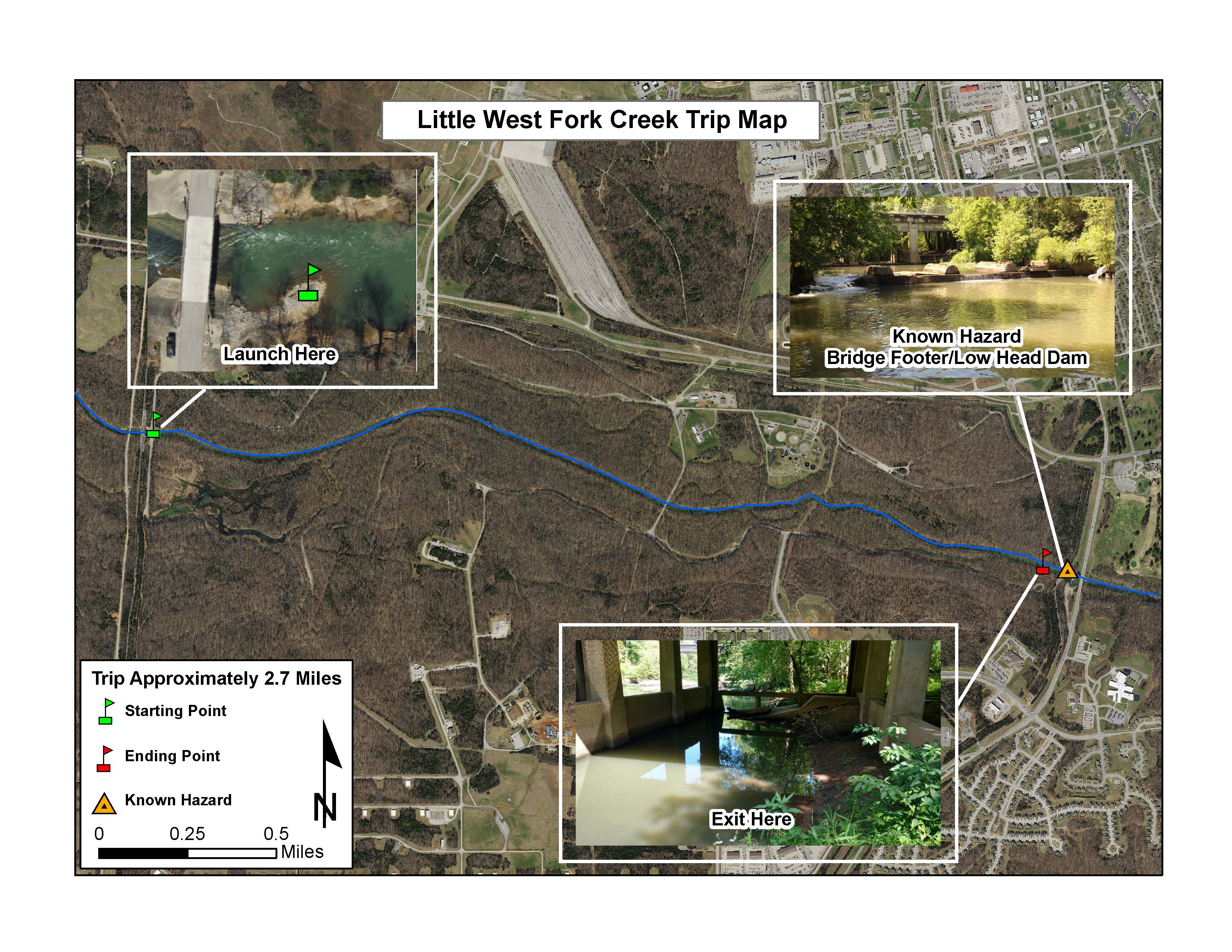
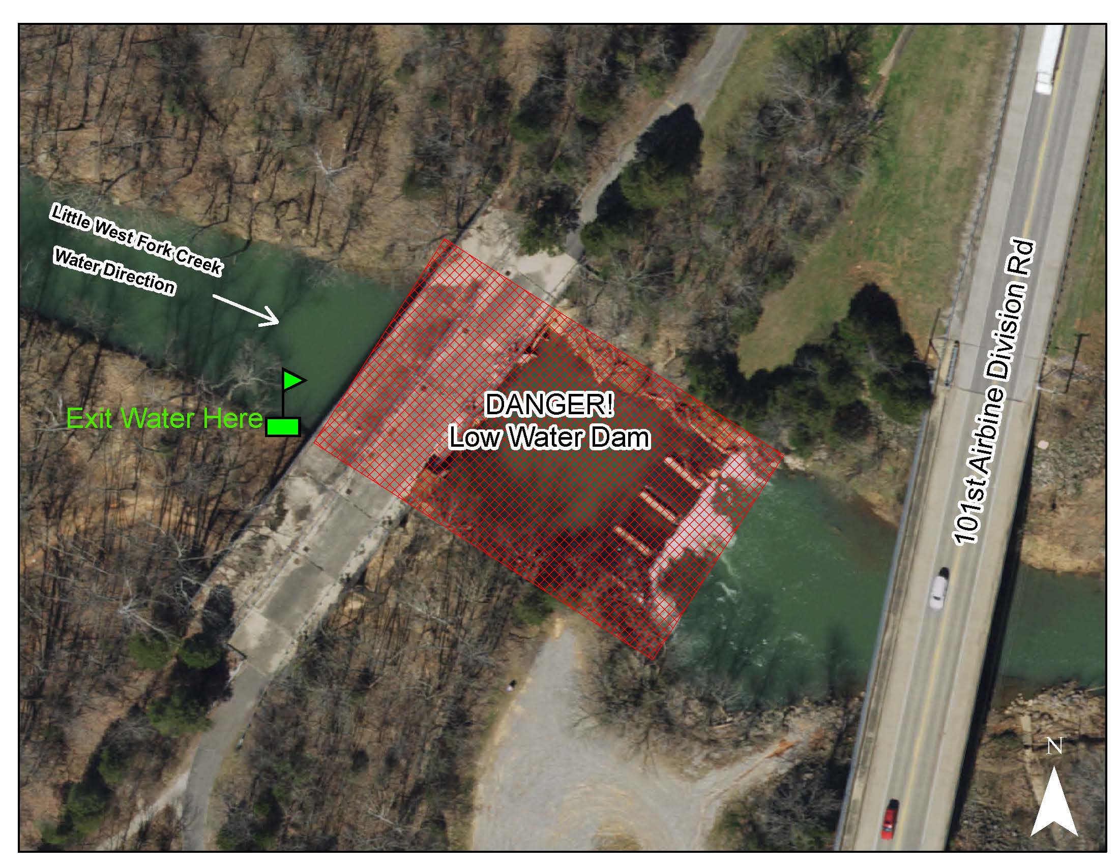
| Recreational Waterways | TA28 Wetland | Lake Kyle | Little West Fork Creek |
|
|
|
|
|
||||
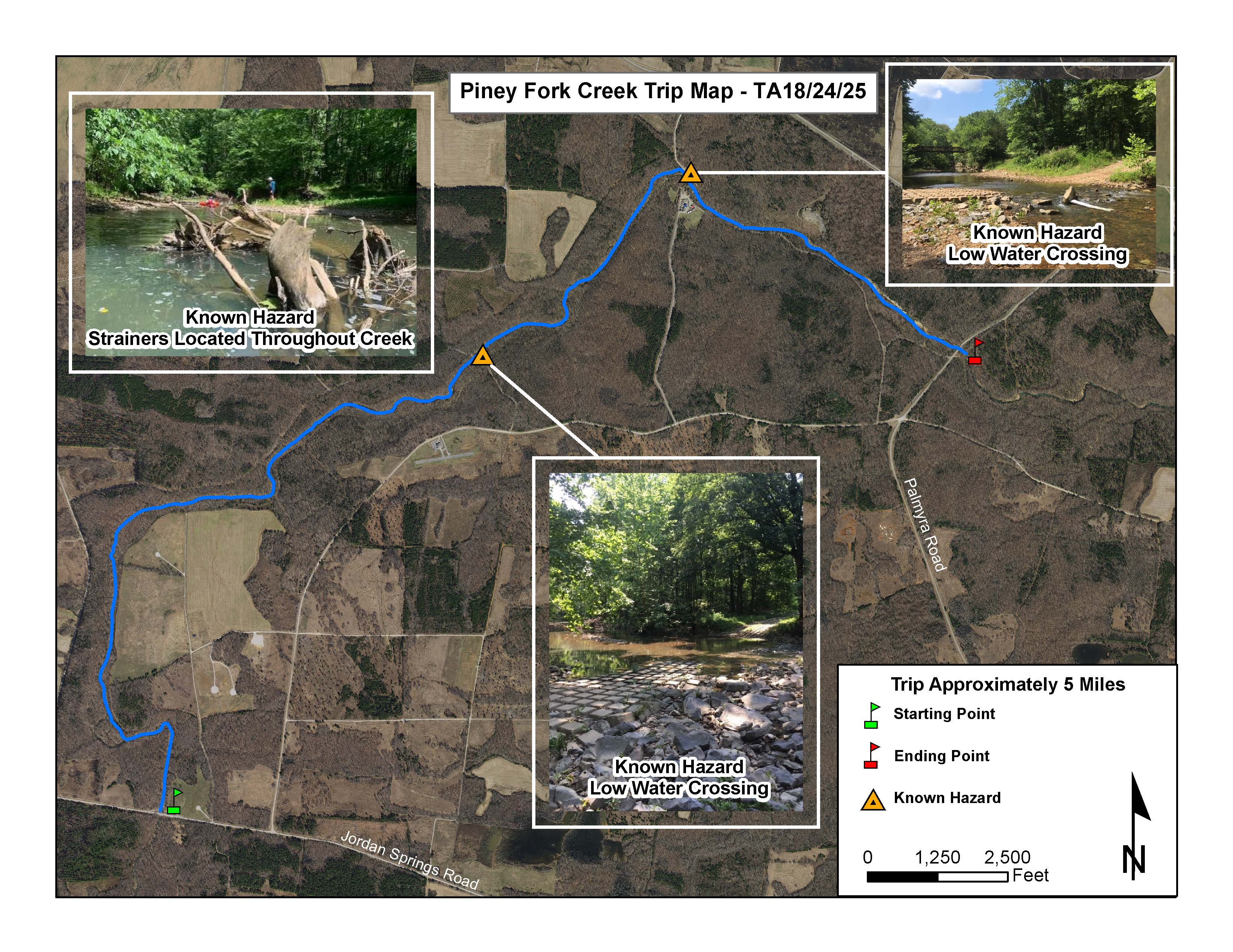
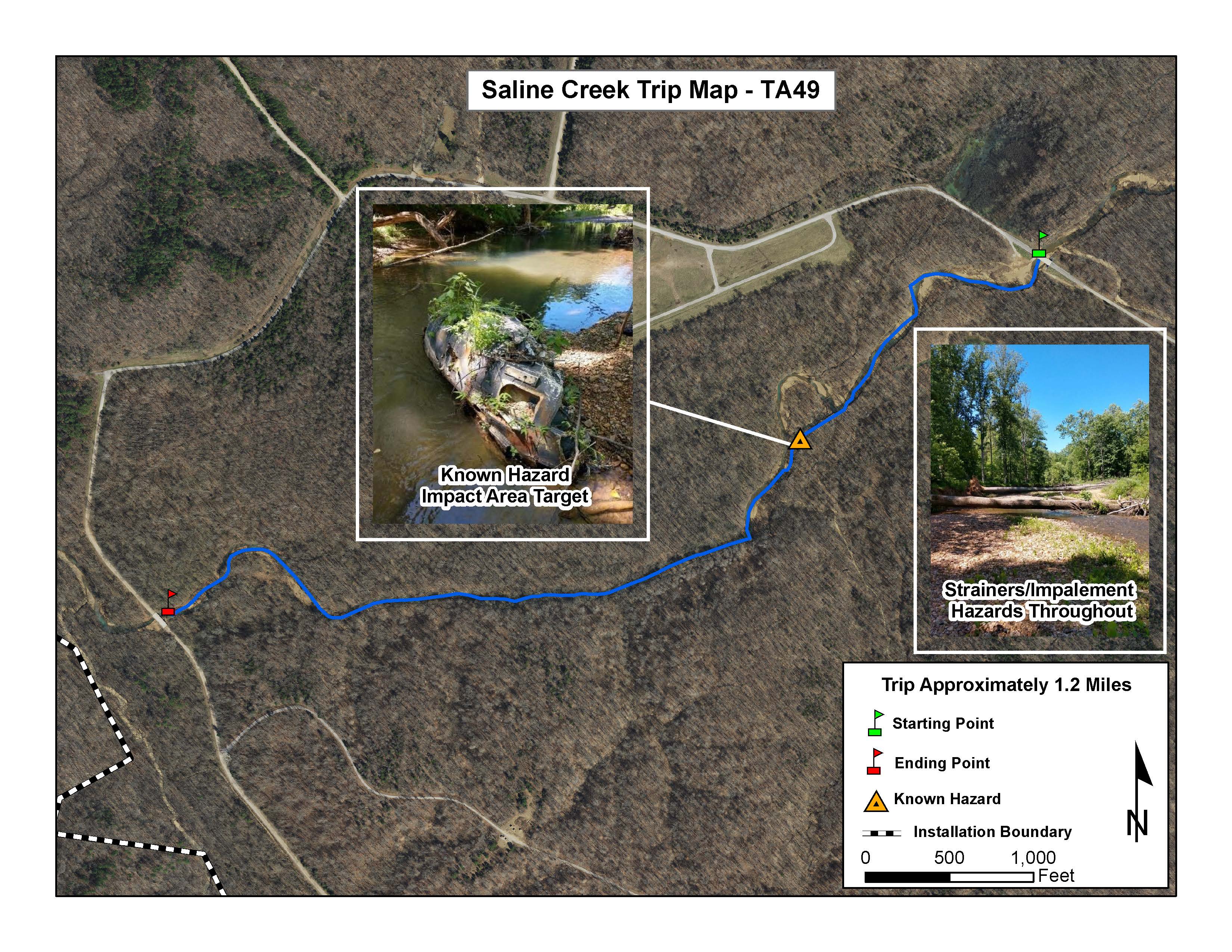
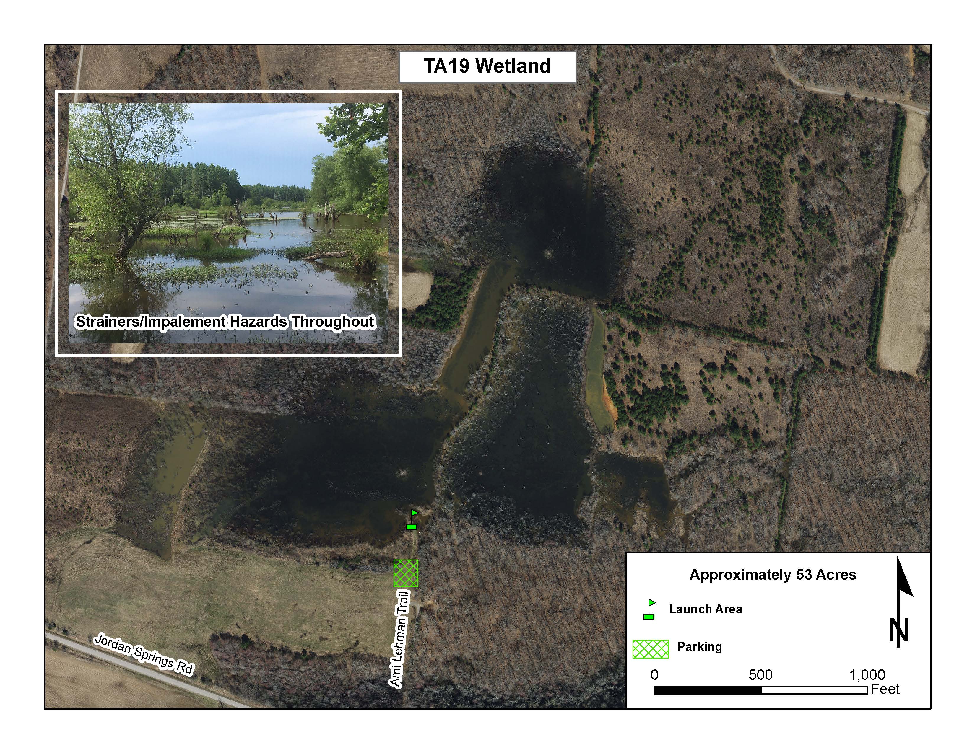
| Little West Fork Creek | Piney Fork Creek | Saline Creek | TA 19 Wetland |
Recreational Off-highway Vehicle Course Map
|
ROV Course |

Handicap Hunting Areas:
- 00HC
- 08HC
- 12HC - See Outdoor Recreation Map
- 14HC - NORTHERN PORTION
- 14HC - SOUTHERN PORTION
- 31HC
Additional Hunting Maps:
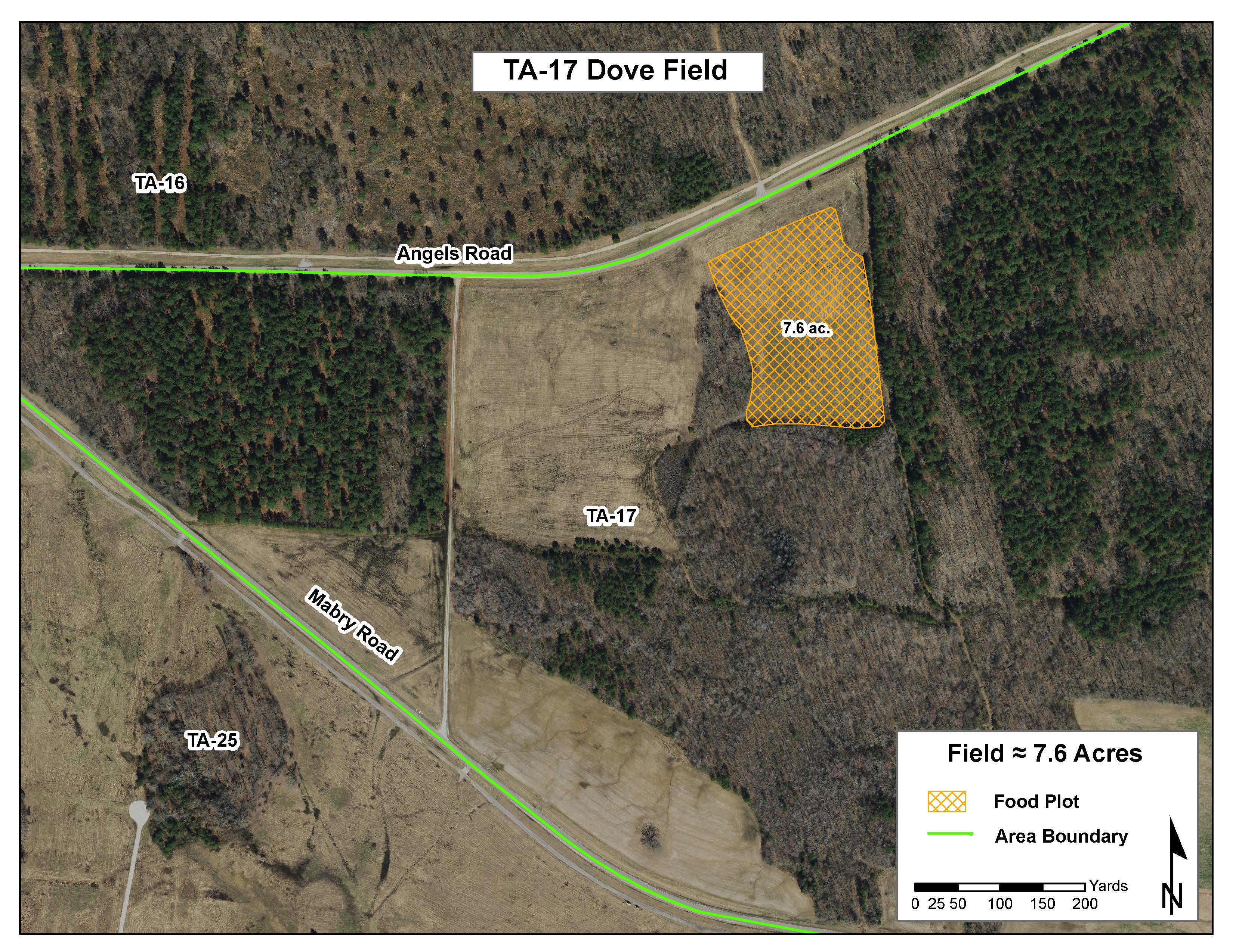
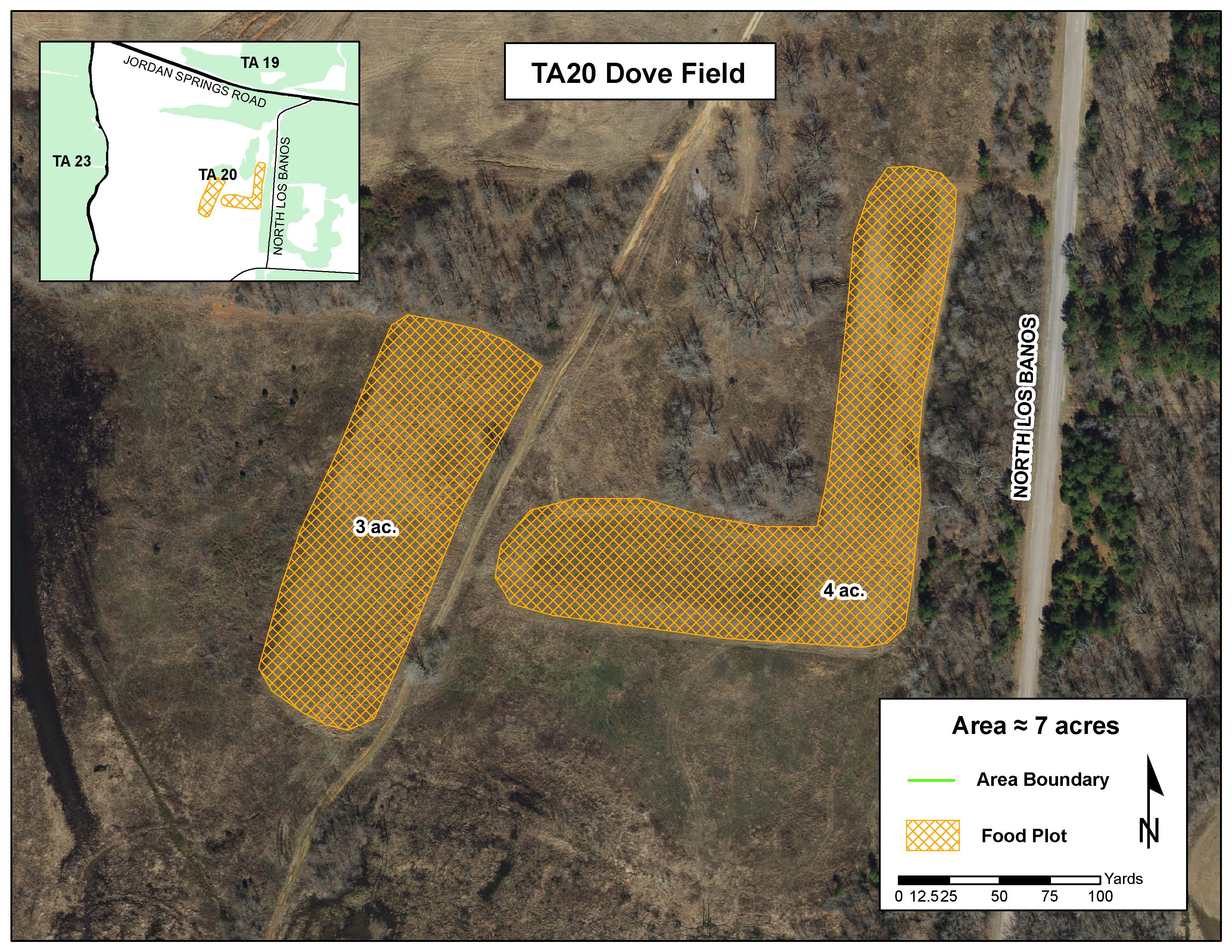
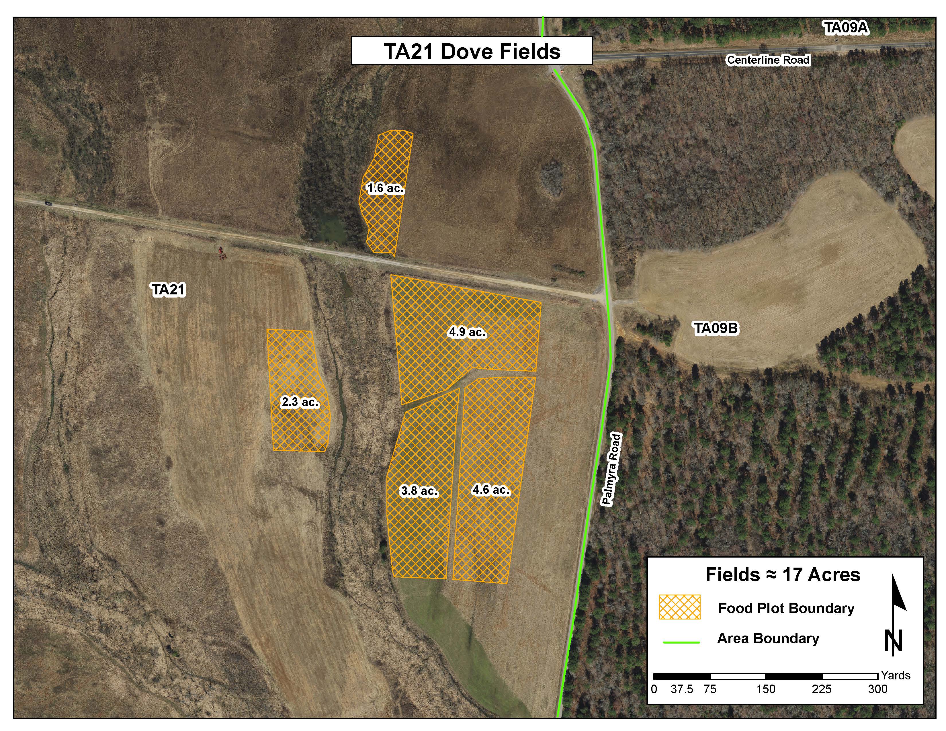
Dove Field Maps
|
|
|
|
||
| TA 17 Dove Field | TA 20 Dove Field | TA 21 Dove Field |
Duck Blinds
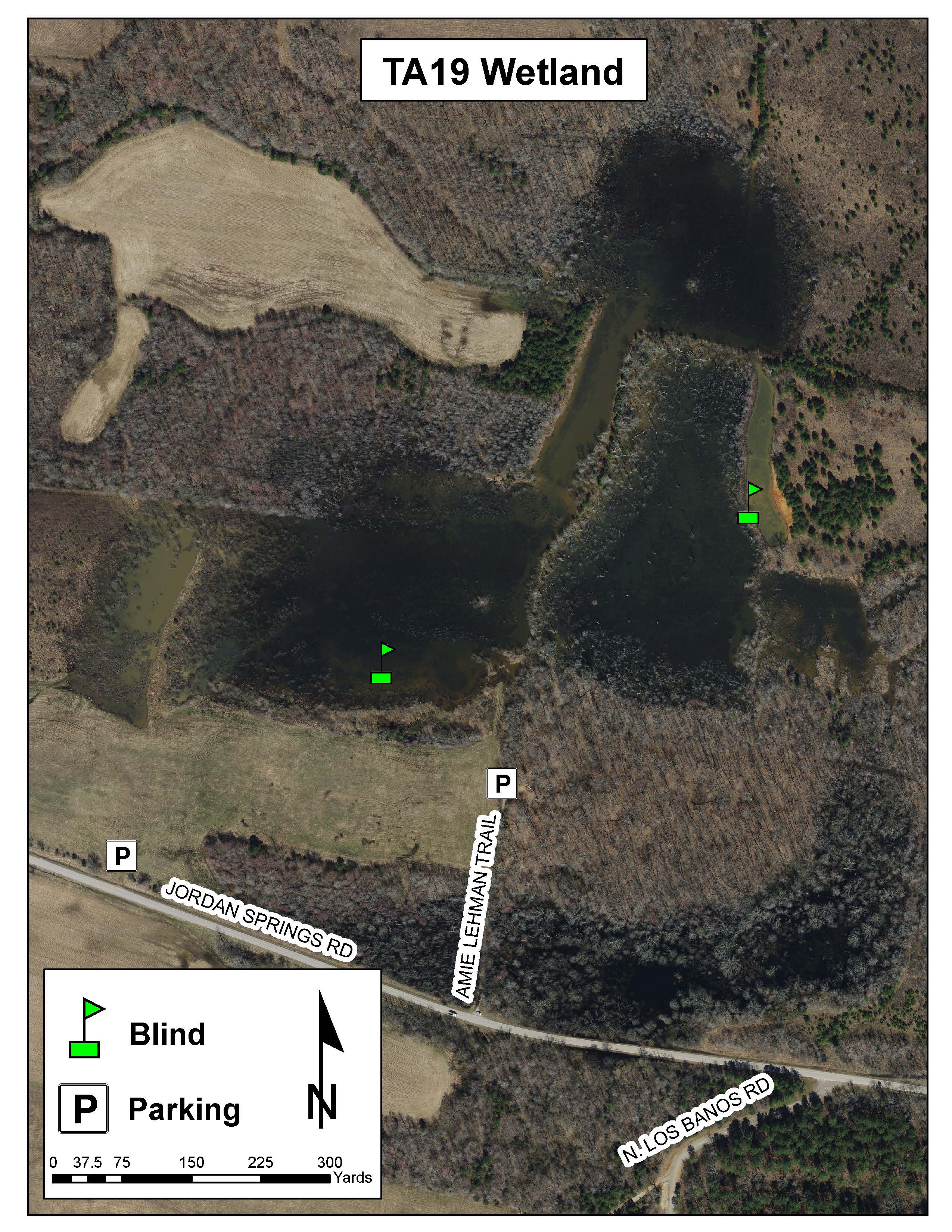
TA 19 Wetland Duck Blinds
Primitive Camping:
PRIMITIVE CAMPING AT LAKE KYLE

Fort Campbell Fish & Wildlife Office:
Directorate of Public Works
Environmental Division, Conservation Branch
Fish and Wildlife Program
Fort Campbell, Kentucky 42223